3D, UAV & internal surveys: Seeing the whole site before design begins
Written by
08 April 2026
•
3 min read

For architects, understanding the full scope of a site before design begins is critical. Traditionally, surveyors would collect a few hundred points across a property to guide initial designs, but today 3D scanning, UAV mapping, and internal surveys are giving architects a complete picture of a site in record time.
Here, Tristan Smythe from C&A Surveyors explains the difference between traditional surveying methods and the latest tech, and explains how it transforms feasibility, risk and workflow for architects and developers.
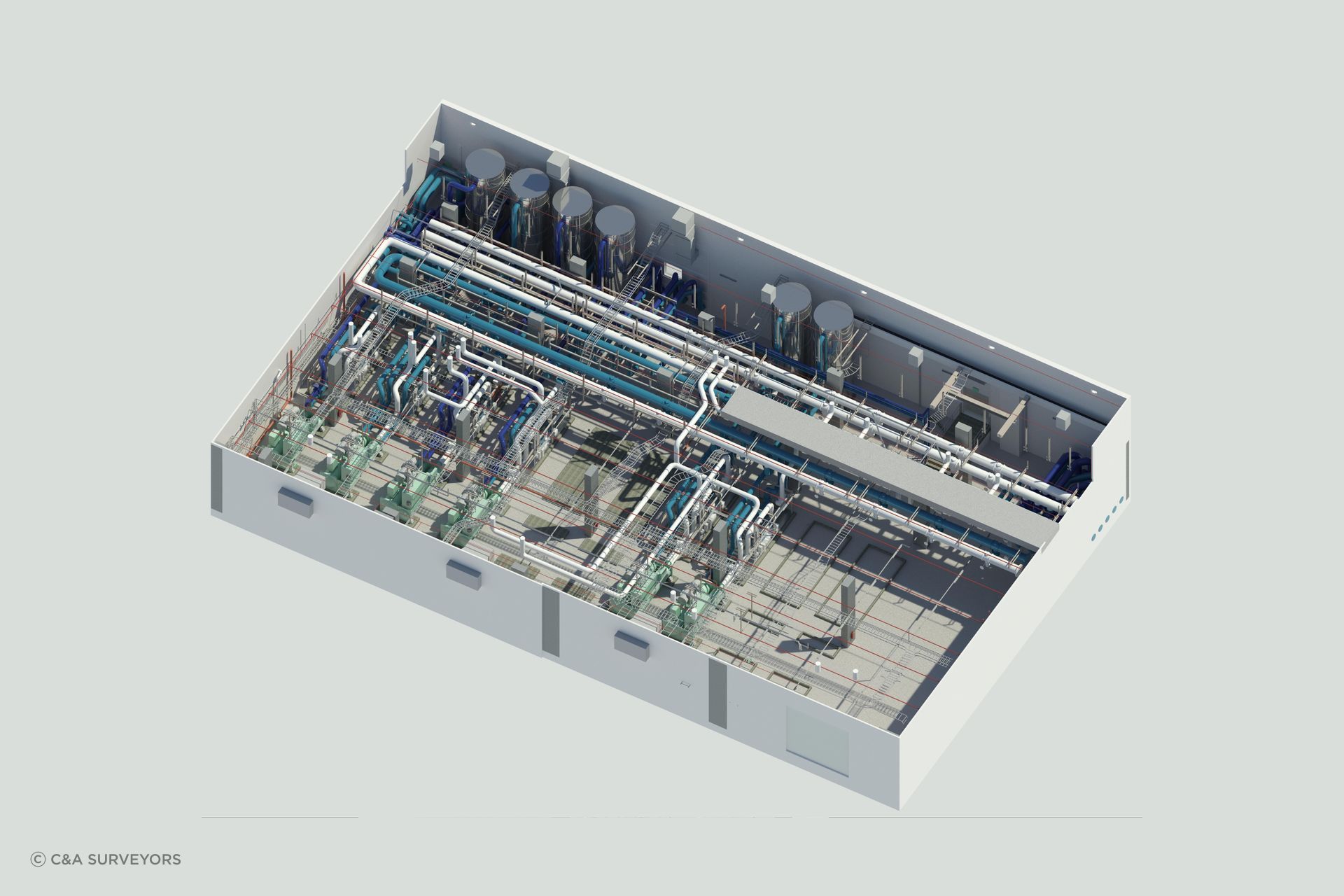
The latest in 3D survey tech
3D scanning, UAV mapping and internal surveys allow architects to capture far more detail than ever before, transforming the way they approach site analysis and planning, says Tristan.
“With a traditional survey, you might pick up three to four hundred points of data per site, but with our 3D scanners, we pick up close to 900 million points. The data is far more complete, and we capture it much faster.”
What this means in real time, is the difference between a half-day traditional survey versus a 30-minute 3D scan.
“Instead of having a surveyor manually choose which points to capture, the laser scanners record every point they can see,” he shares.
This abundance of data has practical benefits for architects. Complex geometries, slopes, or sites with restricted access no longer slow down the design process.
“Often, complex sites can be tricky for traditional manual surveying,” Smythe explains. “But because our 3D laser scanner captures so much information, we can directly transfer that data into a 3D point cloud and then turn it into a full 3D model.”
Architects can now start their designs from a single, accurate source of truth, reducing the need for assumptions or repeated site visits.

Speeding up architect workflows
Integration with architects’ workflows is another major advantage. The data from 3D scans and UAV mapping can be transformed into fully useable models.
“Rather than taking standard two-dimensional plans, we create a full 3D model for the architect,” Tristan says. “There is no guessing, no assumptions based on limited survey points. Everything comes complete, ready for design.”
The technology also saves time and reduces risk. Recently, Tristan heard feedback from an architect who had shifted to 3D surveying and was surprised by how much time it saved him.
“Our 3D surveys saved him 30 to 40 hours of hand modelling. It eliminates unnecessary site revisits and assumptions based on limited data, which means architects can start their design process from reliable information.”
The sheer volume of data ensures nothing is overlooked.
“With a conventional survey, you pick individual points. With a 3D model, you can get any information you want, even on individual bricks if needed. The key advantage is the amount of information we supply, reducing assumptions and allowing the architect to focus on design and creativity.”
For architects working on challenging or innovative projects, the benefits are clear: High-resolution site data supports better decision-making, reduces design errors, and accelerates feasibility and concept work.
As Tristan puts it, “The biggest saving is modelling and drafting time. Our surveys allow architects to start their projects with a one-source-of-truth model, making the design process smoother and more accurate.”